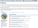
California Statewide Groundwater Elevation Monitoring (CASGEM)
![]()
Since 2009, the California Statewide Groundwater Elevation Monitoring (CASGEM) Program has tracked seasonal and long-term groundwater elevation trends in groundwater basins and non-basin areas statewide.
The Program’s mission is to establish a permanent, locally-managed program of regular and systematic monitoring in all of California's alluvial groundwater basins. This statewide groundwater elevation monitoring continues to act as a tool to help achieve the goals set out under the Sustainable Groundwater Management Act (SGMA).
Senate Bill x7-6, passed by the legislature in 2009, established collaboration between local monitoring parties and DWR to collect statewide groundwater elevations, to be made available to the public. In response to the law, we developed the CASGEM program and the CASGEM Online System.
Collecting and evaluating these groundwater data on a statewide scale is a fundamental step toward improving management of California's groundwater resources. The CASGEM program relies and builds upon the many previously established local long-term groundwater monitoring and management programs. Our role is to coordinate the CASGEM program, to work cooperatively with local entities, and to maintain the collected elevation data in a readily and widely available public database.
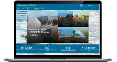
The CASGEM Online System
The CASGEM Online System allows the public access to groundwater elevation data submitted through CASGEM and allows
registered users to log in to submit groundwater information to the CASGEM program.
User guides with step-by-step details on how to navigate the new CASGEM Online System can be found within the Data and Resources portion of the California Natural Resources Agency Open Data page for the CASGEM program.
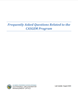
More information is available in the Frequently Asked Questions (FAQ) related to the CASGEM program.
This CASGEM Monitoring Plan Summary describes the basic components of what should be included in a CASGEM monitoring plan.
Information regarding CASGEM Alternative Monitoring Plans can be found in this Fact Sheet.
Groundwater Elevation Monitoring Guidelines were developed to assist DWR by establishing criteria for the selection and measurement of monitoring wells in the event that DWR is required to perform the groundwater monitoring functions in lieu of a local monitoring agency pursuant to Water Code Section 10933.5(a).
Contacts
Northern Region
Debbie Spangler
Senior Engr. Geologist
2440 Main Street
Red Bluff, CA 96080
530-410-3030
Debbie.Spangler@water.ca.gov
North Central Region
Bill Brewster
Senior Engr. Geologist
3500 Industrial Blvd
W. Sacramento, CA 95691
Bill.Brewster@water.ca.gov
South Central Region
Mike McKenzie
Senior Engr. Geologist
691 N. Laverne Ave
Fresno, CA 93727
916-820-7598
Charles.McKenzie@water.ca.gov
Southern Region
Abiodun Aderonmu
Senior Engineer
770 Fairmont Avenue, Suite 200
Glendale, CA 91203
818-621-5728
Abiodun.Aderonmu@water.ca.gov
DWR Headquarters
General Inquires:
casgem@water.ca.gov