Solano County Habitat Restoration Partnership
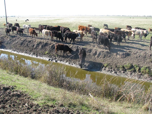
Before restoration, cattle were allowed to freely walk into the Tail Drain Ditch resulting in eroded slopes denuded of vegetation and low water quality, fall 2012.
In partnership with Solano Resource Conservation District (SRCD), Dixon Resource Conservation District, Reclamation Districts 2068, 2098, and 501, landowners, and community volunteers, two categories of projects were accomplished between 2013 and 2019 in the southern Yolo and Solano County area and the Cache Slough Complex.
- The control of non-native invasive plants Arundo (Arundo donax) and red Sesbania (Sesbania punicea). On over 60 miles of levees and canals in southern Yolo and Solano Counties red sesbania was manually removed from levees and waterways by crews using small boats for access. Arundo was treated and removed from 6,000 feet of waterway adjacent to Hastings Cut and all Arundo in the Cache Slough Complex was mapped for future control.
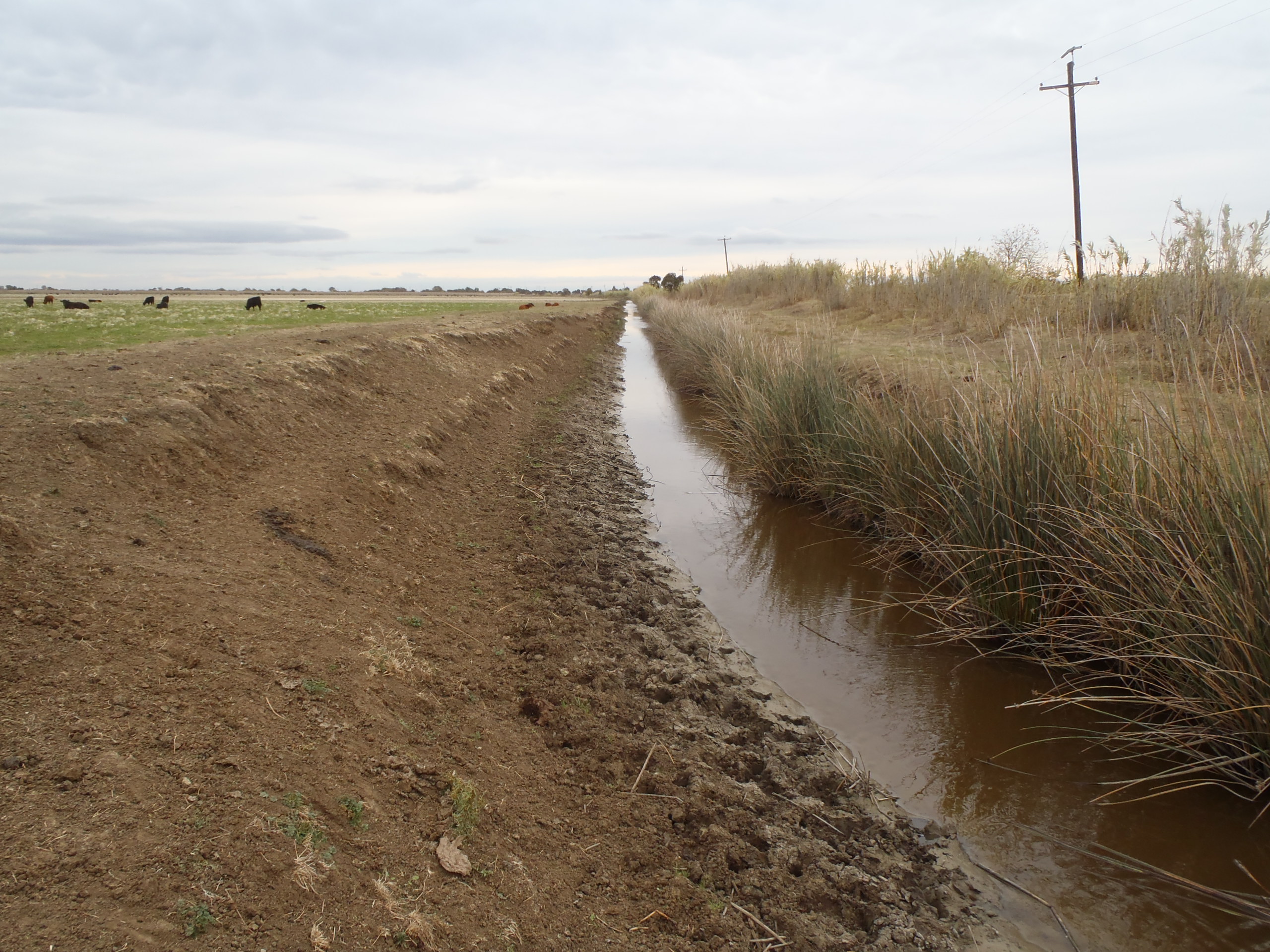
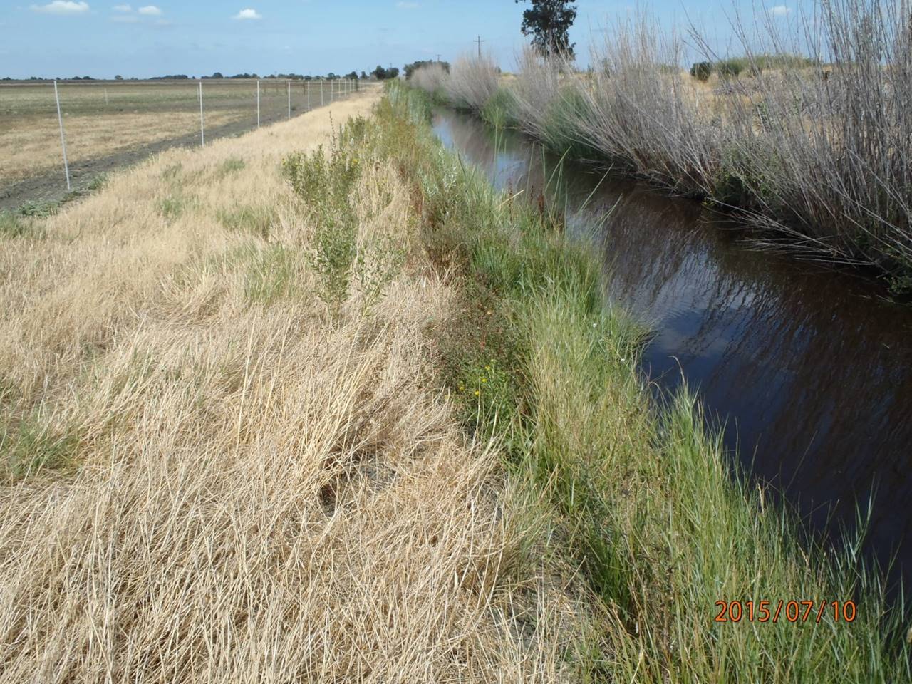
- Creating wildlife/riparian corridors by modifying established irrigation and drainage ditches. Cattle exclusion fences were installed, waterway slopes pulled back, and native riparian vegetation installed to improve water quality, decrease sedimentation, and provide habitat for insects and wildlife. A total of15,700 feet of working waterways were enhanced to create 23.5 acres of riparian and native grassland habitat.
Watershed: San Joaquin and Sacramento Delta – Lindsey Slough Complex and in the Cache Slough Complex
Recreation Features: No
Why is the project needed? What are the project goals?
The project area is mostly irrigated pastureland, crisscrossed with irrigation and drainage canals devoid of native riparian vegetation. Wildlife corridors, once prominent throughout the dendritic channels and sloughs have been replaced by bare dirt irrigation and drainage canals. This project demonstrated the ability to utilize these as riparian corridors for wildlife and native plants through simple modifications that do not interfere with their irrigating functions.
The segregation of cattle from irrigation and drainage canals along with the grading and planting of native vegetation stabilizes the soils, reduces erosion, increases conveyance, and provides improved habitat for birds, insects, and small mammals.
The identification of Arundo infestations will inform future control efforts to remove this highly invasive non-native to increase riparian habitat, reduce fire danger along the levees, and reduce levee degradation during high flow events.
What is the status of the project?
The project is complete. A total of 15,700 feet of working waterways were enhanced to create 23.5 acres of riparian habitat and wildlife corridors. Through a follow-up grant by the Delta Conservancy, more working waterways are undergoing habitat enhancement.
The mapped Arundo was later treated and controlled through the Arundo Removal and Habitat Restoration Project.
Collaboration
DWR and SRCD worked with the Delta Conservancy, area Reclamation Districts, U.S. Army Corps of Engineers, California Department of Fish and Wildlife, U.S. Fish and Wildlife Service, and local landowners to control and map Arundo, and create native riparian habitat on “working waterways’ (irrigation and drainage canals).